Chrispine Omondi uses his technical mapping skills to help people without those skills understand the ways that land is owned and used. After studying geography, he continued to deepen his expertise in GIS (“Geographic Information Systems”), remote sensing (satellite-based information), and artificial intelligence through further study and through work. Now he is putting one of his driving principles – “dare to dream” – into practice, running his own mapping services company called GeoDevOps Limited.
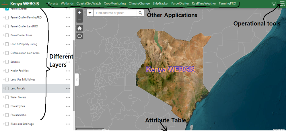
Based in Nairobi, Kenya, Chrispine has developed projects in his home city and beyond. His main project is Kenya WEBGIS: a public portal that hosts geospatial data with operational layers, that include projects in urban and rural areas, and along coastlines. Each project involves accessing to the most reliable data possible, processing and organizing the data, and then designing the format for presenting it in a way that is easy for people to interpret and use: an act of visual translation.
Strengthening transparency of land parcels in Nairobi
Chrispine has created a Cadastral App that shares the dimensions and ownership of land parcels in Langata, Nairobi. Another application, COGO Parcel drafter for land surveyors, enables surveyors to input the spatial dimensions of the land parcels they are surveying. They can then digitize and update the land parcel information after completing the survey.
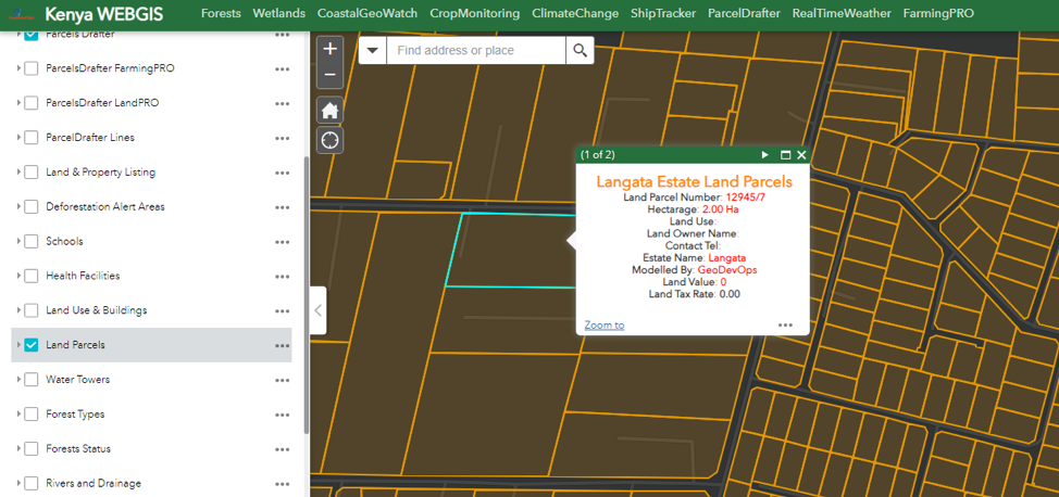
Chrispine says that transparency and sharing of ownership patterns is important to provide clarity for investors and to help curb corruption. Frequently, land parcels can be sold to two different people resulting in two separate titles and entries in the land registries. This brings confusion and a lack of confidence on land transactions and ownership. In many areas in Nairobi and beyond, lack of secure or transparent tenure increases vulnerability to land-grabbing and evictions. This is reflected for example in the situation of Kenya’s public schools: a 2023 report found that approximately 70% of the country’s public schools do not have title deeds.
Lack of title deeds and public information on land ownership make it easier for land agents and government officials to collude in illegal land deals.
Recent Court cases and rulings reflect this issue. For example the Ethics and Corruption Commission (EACC) recovered public land worth over 70 million Kenyan Shillings (approx. 500,000 USD) that had been allocated to private developers in Nyali, Mombassa County. The judge also ordered two companies involved and the former Commissioner of Lands to pay damages for denying government use of the property for 22 years.
In a ruling in May 2023, Kenya’s Supreme Court strengthened scrutiny and accountability on land titles. A property title can now be invalidated if the process that preceded its issuance did not comply with the law, regardless of whether buyers were aware of irregularities; property investors and lenders now have to carry out greater due diligence on the history and legality of titles; and the burden of proving the legality and validity of title now rests with the buyer.
Chrispine believes that the creation of a public portal with updated information on land maps, land ownership and historical records helps to streamline and justify transactions and land ownership, bringing more confidence to investors and land owners, and evidence against illegal land deals.
Helping smallholder farmers map and digitize their farmlands
Chrispine also developed a FarmingPRO platform to help farmers map, digitize and integrate their farmlands to a cloud platform for crop monitoring. This is in a context in which agriculture accounts for about a third of Kenya’s economy, with the majority of farmers working on a smallholding basis – the country has around 4.5 million farming households. Yet as FarmingPRO highlights, land and water resources are limited and stressed due to demand for food, space for settlement and the impacts of climate change.
FarmingPRO uses new technologies in Earth Observation and AI to help farmers improve the quality and quantity of their produce. Farmers receive historical records of their fields as well as predictions of soil conditions, crop health, terrain, and weather. This helps identify which parts of the farm may be at the highest risk of moisture stress or erosion, pest infestation or disease and therefore need the most attention.
Tracking the environmental health of Africa’s coastlines
In “Africa Coastal Geo-Watch” Chrispine is creating a map of Africa’s coastal ecosystems. The map provides insights on the location of ecological features such as mangroves, seagrass and corals, and the possible processes affecting them such as changing sea temperatures and coastal erosion: spotlighting areas of vulnerability and risk.

Chrispine continues to dream. For example, he is working on processes to track and share changes in land ownership back in time and as they happen. His work is an example of map-making for social and economic change. It illustrates the major possibilities in bridging geoscientists’ technical skills with those who are working to improve how the finite and vulnerable resource of land is governed, used and sustained: from individual plots to continental coasts.
One response to “GeoDevOps: Practical mapping for change in Kenya”
[…] Nairobi: GeoDevOps and KenyaWebGIS […]